James Niehues
On the power of paint over pixels.
James Niehues needs no introduction His name is the one carefully painted in the corner of countless trail maps all over the country and world. A few years ago I had the chance to asked him a few questions about his perspective on the industry.


BLANCHARD
SlopeFillers: Let’s just start with some background on you and the maps your create.
James: The use of the trail map is first and foremost to get skiers and riders around the Mountain – as clearly as possible. Now, that being said, then a simple line diagram with trail names and difficulty should be adequate. And in some cases that is exactly what is used. But this image is seen by most every skier on the mountain and it is pulled out by many after the day over a beer and the day’s skiing is retraced with enthusiastic descriptions, both good and bad. It is what is pulled up on a resort’s site to dream about the next ski trip, and become a factor in deciding which resort is the next vacation. It’s getting away for a day on the Mountain, enjoying not only the sport of skiing or riding but the scenery, which deliver the exhilaration that comes with the great outdoors and a run down the mountain.
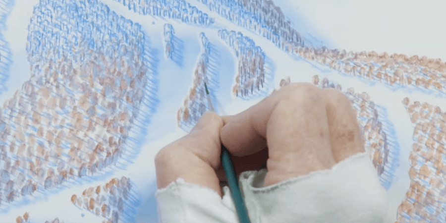
Therefore it is beneficial to highlight these attributes with the trail map, which is getting the most impressions of any promotional image the resort may put out. The more attractive the image the more good feelings are touched upon and provide a “tug”. I have used a phrase that I believe is very true. “A quality trail map image reflects a quality ski resort experience.” Yes, I use the computer, but only to reproduce the image and make some color adjustments once the hand painted image is rendered. Why not use the computer to render the image? One very important reason – Nature is very intricate and diverse, best represented in the free rendering of the brush.
The computer image is limited and repetitive delivering not only a less than effective interpretation of nature but is most connected with the work place and office, the place that one is getting away from. Well, maybe that is two reasons – along with other creative and productive factors that I will not get into here.
SlopeFillers: James, it’s hard to ski anywhere in the country without seeing your signature in the corner of a map. How and when did you get started doing resort maps and what was your first one?
James: My first full trail map was Boreal, California, a small ski area on Donner Pass, in 1988. I had made contact with Bill Brown and produced the inset image of The Back Side of Mary Jane for Winter Park, Colorado. I made slides of this image and mailed them out to all the West’s Resorts, from which Boreal was the first response. I had a full time job and would get up at 3 AM to paint before going to work at 8AM. I was so excited about it I couldn’t wait to get up, sometimes waking at 2 AM!
SlopeFillers: Since you started producing maps, what would you say has been the biggest change in the ski industry that you have witnessed from your unique perspective?
James: Changes in the Ski Industry? Well, my unique service doesn’t put me in touch with the total workings of the resort so I’m not inclined to venture an opinion. But, in the print industry great changes have affected the way I work and deliver the product to the client. During my first years a 4 piece film separation was make with filters through the graphic camera lens They were Magenta, Yellow, Cyan and Black. Each film was burned onto a metal plate and put on a print press where it was registered to the other colors by hand in most cases. There was limited color correction and a person would need to put each film on a light box to opaque out dust images with a brush.
To make it more feasible for the client, who usually worked with a local printer, I would send them the 8x10inch transparency and the printer would have the films pulled. A graphic artist would actually have the trail names typeset and would paste them up on a mylar layer over the image. If the words needed to be curved a cut would be made between each letter and the glued or waxed letters would be bent and pressed into position.
Each line was drawn with a technical ink pen and if you wanted dashes an exacto knife would scrape the ink off. Register marks were a must to align the various layers. Today the software like Adobe Illustrator in the hands of a good graphic artist does all of this in minutes as compared to hours. Then there is the transmission of files. I used mail and Fed-X, now I use the internet, cutting time and expense. Yes, the computer has made the biggest change in the last twenty years but it still isn’t the best way to paint scenery….at least not in my opinion!
SlopeFillers: I’ve got to ask, what was your job previous to do maps and why did painting trail maps pique your interest?
James: I was a partner of a two man advertising agency in Grand Junction Colorado. My forte was the graphics side. Prior to that I set up and oversaw an inhouse print shop for an after-market auto instrument manufacturer
SlopeFillers: From your point about technology, do you ever worry that technology will replace talent? Types of photographs that took hours to produce can now be achieved with an iPhone and a simple app and suddenly it seems those types of pictures aren’t quite as cool anymore. Do you ever worry that the intricacies of hand painted trail maps will be lost when computers can begin to render something that appears “hand painted”?
James: The short answer….YES. I may very well be the last artist to paint trail maps by hand, but I certainly hope not. A lot will be lost, the mind is still more adaptable and creative in presentation. I can stretch, bend, turn or twist parts of the mountain individually without affecting other elements…and it is almost instantaneous in my mind….just practice. It is yes because the computer imagery is more and more “accepted” by the general public, especally since GoogleEarth (which is far from the ultimate representation of terrain)…and not all that accurate. But people looking at it believe it is.
GoogleEarth has lowered the bar by making cartography seem easy. But one of the marks of great cartography is to quickly educate the viewer to a full understanding of the terrain, which I think I do better!
SlopeFillers: I think millions of skiers would agree with you, James.
About Gregg & SlopeFillers
I've had more first-time visitors lately, so adding a quick "about" section. I started SlopeFillers in 2010
with the simple goal of sharing great resort marketing strategies. Today I run marketing for resort ecommerce and CRM provider
Inntopia,
my home mountain is the lovely Nordic Valley,
and my favorite marketing campaign remains the Ski Utah TV show that sold me on skiing as a kid in the 90s.
Get the weekly digest.
New stories, ideas, and jobs delivered to your inbox every Friday morning.
